
Archaeology: Traces of ancient harbour found off Bulgaria’s Black Sea coast
An underwater expedition by the National Historical Museum has uncovered traces of an ancient and mediaeval harbour near Cape Killick, close to the village of Bliznatsi on Bulgaria’s Black Sea coast, the museum said on September 24.
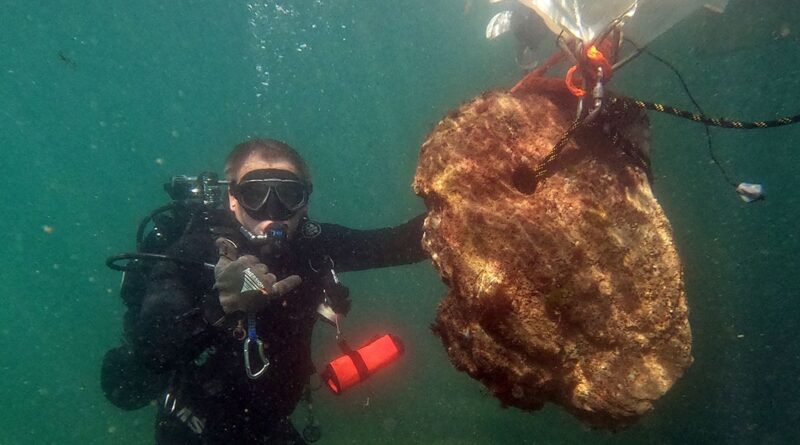
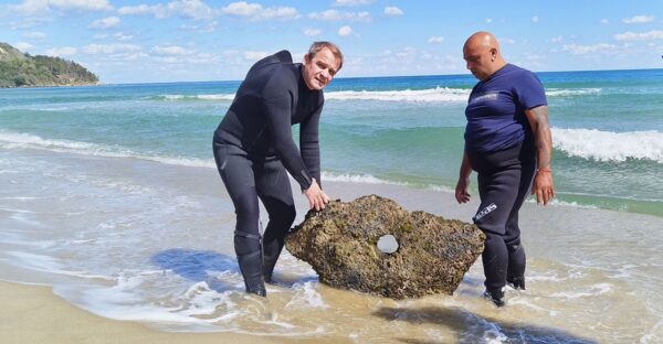
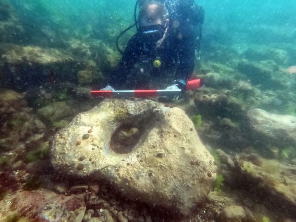
More 300 finds—including amphorae, anchors, pottery fragments, and a sunken ship—tell the story of a forgotten trading centre that served the fortress of Erite.
“The area is poorly explored but is already revealing new chapters of our maritime history,” the museum said in a Facebook post.
The expedition was conducted from September 17 to 23 2025.
Initial excavations conducted in 2023 led to the discovery of a number of valuable finds related to ancient shipping in the Western Pontus: amphorae, stone stocks, a tin ingot, iron anchors and the remains of a late mediaeval shipwreck.
Based on these findings, archaeologists hypothesized that the area of Cape Killik was a shelter for ships in bad weather, as well as an active port serving the ancient settlement of Erite.
“The goal of the second stage of the research was to establish the boundaries of the port area to the late antique fortress of Erite, as well as to map important underwater elements – rocks, reefs and concentrations of movable cultural property,” the museum said.
The fortress of Erite itself is marked on the famous ancient map Tabula Peutingeriana. According to the data in it, along the Black Sea coast within the province of Moesia Inferior, there were road stations, including Odessos (Varna), Erite (at the mouth of the Kamchia River) and Templum Jovis (probably near the present-day city of Obzor). All three were important port centres, located directly on the seashore or at the mouth of rivers – that is, safe harbours.
During this year’s underwater expedition, 348 fragments of antique and late antique ceramic vessels and amphorae were registered.
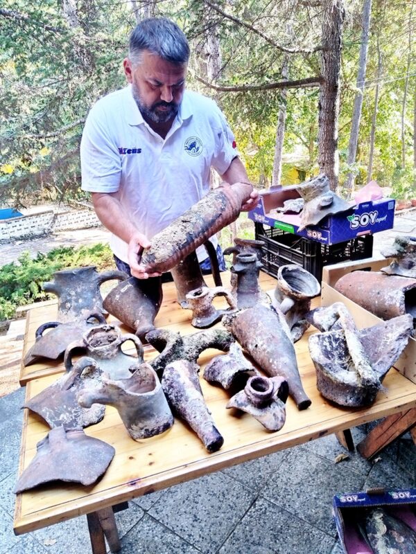
Among them, amphorae originating from Heraclea, Chios, the island of Kos are recognized, as well as Roman amphorae of types LR1 and LR2, North African amphorae and others. The fragments found cover a wide chronological range, marking the inventory of vessels and the accumulation of materials typical of port areas.
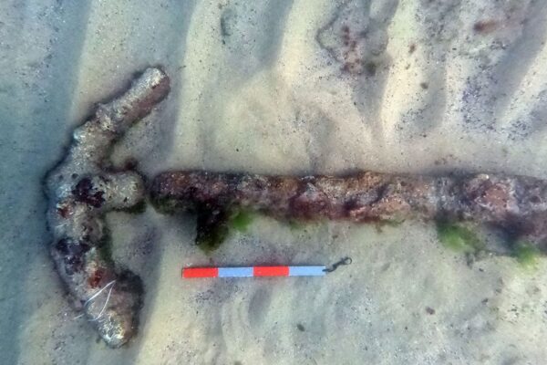
Among the earliest finds are three stone anchors with one hole, which can be dated to the beginning of the 1st millennium BCE at the earliest.
The three iron anchors from the Roman period are extremely valuable. They belong to type “B”, known in the scientific literature as “Roman early imperial” according to the classification of G. Kapiten. Of particular interest is an iron anchor from the Middle Ages – type “E” (according to the same classification), typical of the period 7th–11th centuries. It is the only certain evidence of the use of the bay in the Middle Ages.
Based on the data collected, it can be concluded that the water area south of Cape Killik functioned as a place for loading and unloading activities from the beginning of the 1st millennium BCE to the beginning of the 7th century.
During the late Middle Ages, several vessels sank there.
The geomorphology of the cape, which in the past probably extended further into the sea, formed a natural protected port area. In bad weather conditions, this area provided a safe haven for ships that could not safely dock at the mouth of the Kamchia River.
Excavations are underway at the Erite fortress, where archaeologists can expect new interesting discoveries.
Erite has been described as having been a mansio – a road station.
In the Roman Empire, a mansio was an official stopping place on a Roman road for the use of officials while travelling, for rest and recreation. Usually built as villas, mansios were customarily spaced apart on the basis of a distance that could be travelled in a day.
(Photos: National History Museum)


